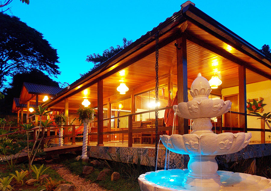
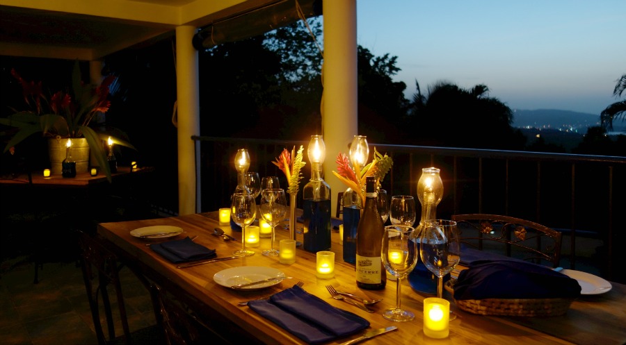
Enjoy an amazing experience as you exchange your vows overlooking the pristine Macal River and surrounding jungle while spending 5 glorious nights in the heart of Belize’s jungle frontier. Climb ancient Mayan ruins or thrill to an adventurous caving excursion, enjoy the lodge's award winning grounds and gourmet cuisine, and relax as our dedicated staff makes all the preparations for the intimate destination wedding you’ve always envisioned.
On-site Activities
Enjoy all that the lodge’s 105-acre reserve has to offer. There’s plenty to do without ever stepping foot off the property.
Guided Excursions
Mayan ruins, caving adventures, cultural experiences, and natural wonders— whatever your interests, the lodge offers all the best adventure and sightseeing tours in a small group setting and with the very best Gold Standard Certified guides in the country.
San Ignacio
San Ignacio and Santa Elena are towns in western Belize. San Ignacio serves as the cultural-economic hub of Cayo District. It got its start from mahogany and chicle production during British colonisation. Over time it attracted people from the surrounding areas, which led to the diverse population of the town today. San Ignacio is the largest settlement in Cayo District and the second largest in the country, after Belize City.
History
The town was originally named El Cayo by the Spanish. On 19 October 1904, El Cayo was officially declared a town by the government of British Honduras. In the past a creek ran between the Macal and the Mopan rivers one mile outside of San Ignacio going toward Benque Viejo. This creek then fulfilled the definition of an area of land completely surrounded by water and thus the name Cayo, "island". There was a large wooden bridge across this creek in the late 1940s, but since the creek eventually dried up, the area was filled with limestone gravel and today there remains no evidence of its existence. The demise of the creek, however, took away the distinction for the classification of a 'cayo' from the venerable western town of 'El Cayo' and returned it to a regular land mass.
Geography
San Ignacio is situated on the banks of the Macal River, about 63 miles (101 km) west of Belize City and 22 miles (35 km) west of the country's capital: Belmopan. The town has an area of approximately 2.5 square miles (6.5 km2).
Demographics
The population is largely Mestizo, followed by Kriol, and some Lebanese and Mopan Maya. San Ignacio also boasts a fairly large Chinese population, most of whom emigrated from Guangzhou in waves in the mid-20th century. The Mennonite community of Spanish Lookout is situated a few miles outside San Ignacio. The 2010 census counted 17,878 inhabitants in San Ignacio and Santa Elena, of whom 8,751 are males and 9,127 are females. The total number of households is 4,351 and the average household size is 4.1.
Santa Elena
In recent years San Ignacio has absorbed the formerly separate village of Santa Elena. San Ignacio and its sister-town Santa Elena make up Belize's second largest urban area. The two towns are connected by Belize's only suspension bridge, the one-lane Hawkesworth Bridge across the Macal river, built in 1949. The two are collectively referred to as the "Twin Towns" although San Ignacio has a larger population. As of 2010, Santa Elena has a population of 7,389 compared with San Ignacio's population of 10,489.
Government
San Ignacio is currently governed by a town council affiliated with the United Democratic Party (UDP). The mayor is Earl Trapp, also of the UDP. Town council elections are held every three years to elect the mayor and council. Both UDP and People's United Party (PUP) candidates participate in town elections. The next municipal elections are scheduled for the year 2020.
At the national level, the San Ignacio/Santa Elena area is represented by three constituencies in the Belize House of Representatives, Cayo Central, Cayo North and Cayo North East.
Educational institutions
San Ignacio has three main colleges. Sacred Heart College of Catholic denomination is the largest institution, with both a high school and a junior college division, and is one of the largest high schools in Belize. Eden Seventh Day Adventist High School and Saint Ignatius High School (Catholic) are also found here.
Galen University was founded in 2003 and is located at Central Farm, a couple of minutes east of San Ignacio. The University of Belize also has an agricultural campus next to Galen.
Health care
The city is served by the San Ignacio Hospital, which is a regional clinic, and the Loma Luz Adventist hospital in Santa Elena. It also has various clinics, doctors and pharmacies scattered around town, and "the only official medical electives program run by Belizians."
Attractions
The area around San Ignacio is one of the most popular parts of the country for tourism. Nearby attractions include the ancient Maya ruins of Caracol, Xunantunich, Cahal Pech, and El Pilar. Notable caves to explore include the Actun Tunichil Muknal cave, which includes skeletons, ceramics, and stoneware, and Barton Creek Cave, which is popular among adventure tourists interested in cave canoeing.
Also popular among adventure travelers are nature reserves such as the Chaa Creek Nature Reserve, and the Mountain Pine Ridge Forest Reserve. A day trip to Mountain Pine Ridge allows visitors to go on several hikes and visit waterfalls, caves, and Maya ruins.
Belize
Belize is a Caribbean country on the northeastern coast of Central America. It borders Mexico to the north, the Caribbean Sea to the east, and Guatemala to the west and south. It has an area of 22,970 square kilometres (8,867 sq mi) and a population of 419,199 (2020). Its mainland is about 290 km (180 mi) long and 110 km (68 mi) wide. It has the lowest population and population density in Central America. Its population growth rate of 1.87% per year (2018 estimate) is the second-highest in the region and one of the highest in the Western Hemisphere. Its capital is Belmopan, and its largest city is Belize City.
The Maya civilization spread into the area of Belize between 1500 BC and AD 300 and flourished until about 1200. European contact began in 1492 when Christopher Columbus sailed along the Gulf of Honduras. European exploration was begun by English settlers in 1638. Spain and Britain both laid claim to the land until Britain defeated the Spanish in the Battle of St. George's Caye (1798). In 1840 it became a British colony known as British Honduras, and a Crown colony in 1862. It achieved its independence from the United Kingdom on 21 September 1981.
Belize has a diverse society that is composed of many cultures and languages that reflect its rich history. It is the only Central American country where English is the official language, while Belizean Creole is the most widely spoken dialect. Spanish is the second most commonly spoken language, followed by Mayan languages, German dialects, and Garifuna. Over half the population is multilingual, due to the diverse linguistic backgrounds of the population. It is known for its September Celebrations, its extensive barrier reef coral reefs, and punta music.
Belize's abundance of terrestrial and marine species and its diversity of ecosystems give it a key place in the globally significant Mesoamerican Biological Corridor. It is considered a Central American and Caribbean nation with strong ties to both the American and Caribbean regions. It is a member of the Caribbean Community (CARICOM), the Community of Latin American and Caribbean States (CELAC), and the Central American Integration System (SICA), the only country to hold full membership in all three regional organizations. It is the only mainland Central American country which is a Commonwealth realm, with Queen Elizabeth II as its monarch and head of state, represented by a Governor General (currently, Dame Froyla Tzalam). It is considered a tax haven.
Etymology
The earliest known record of the name "Belize" appears in the journal of the Dominican priest Fray José Delgado, dating to 1677. Delgado recorded the names of three major rivers that he crossed while travelling north along the Caribbean coast: Rio Soyte, Rio Kibum, and Rio Balis. The names of these waterways, which correspond to the Sittee River, Sibun River, and Belize River, were provided to Delgado by his translator. It has been proposed that Delgado's "Balis" was actually the Mayan word belix (or belize), meaning "muddy-watered". More recently, it has been proposed that the name comes from the Mayan phrase "bel Itza", meaning "the road to Itza".
In the 1820s, the Creole elite of Belize invented the legend that the toponym Belize derived from the Spanish pronunciation of the name of a Scottish buccaneer, Peter Wallace, who established a settlement at the mouth of the Belize River in 1638. There is no proof that buccaneers settled in this area and the very existence of Wallace is considered a myth. Writers and historians have suggested several other possible etymologies, including postulated French and African origins.
Early history
The Maya Civilization emerged at least three millennia ago in the lowland area of the Yucatán Peninsula and the highlands to the south, in the area of present-day southeastern Mexico, Belize, Guatemala, and western Honduras. Many aspects of this culture persist in the area, despite nearly 500 years of European domination. Prior to about 2500 BC, some hunting and foraging bands settled in small farming villages; they domesticated crops such as corn, beans, squash, and chili peppers.
A profusion of languages and subcultures developed within the Maya core culture. Between about 2500 BC and 250 AD, the basic institutions of Maya civilization emerged.
Early colonial period (1506–1862)
Spanish conquistadors explored the land and declared it part of the Spanish Empire, but they failed to settle the territory because of its lack of resources and the hostile tribes of the Yucatán.
English pirates sporadically visited the coast of what is now Belize, seeking a sheltered region from which they could attack Spanish ships (see English settlement in Belize) and cut logwood (Haematoxylum campechianum) trees. The first British permanent settlement was founded around 1716, nearly 200 years after the Spanish had initially arrived, in what became the Belize District, and during the 18th century, established a system using enslaved Africans to cut logwood trees. This yielded a valuable fixing agent for clothing dyes, and was one of the first ways to achieve a fast black before the advent of artificial dyes. The Spanish granted the British settlers the right to occupy the area and cut logwood in exchange for their help suppressing piracy.
The British first appointed a superintendent over the Belize area in 1786. Before then the British government had not recognized the settlement as a colony for fear of provoking a Spanish attack. The delay in government oversight allowed the settlers to establish their own laws and forms of government. During this period, a few successful settlers gained control of the local legislature, known as the Public Meeting, as well as of most of the settlement's land and timber.
Throughout the 18th century, the Spanish attacked Belize every time war broke out with Britain. The Battle of St. George's Caye was the last of such military engagements, in 1798, between a Spanish fleet and a small force of Baymen and their slaves. From 3 to 5 September, the Spaniards tried to force their way through Montego Caye shoal, but were blocked by defenders. Spain's last attempt occurred on 10 September, when the Baymen repelled the Spanish fleet in a short engagement with no known casualties on either side. The anniversary of the battle has been declared a national holiday in Belize and is celebrated to commemorate the "first Belizeans" and the defence of their territory taken from the Spanish empire.
Independent Belize (since 1981)
Belize was granted independence on 21 September 1981. Guatemala refused to recognize the new nation because of its longstanding territorial dispute with the British colony, claiming that Belize belonged to Guatemala. About 1,500 British troops remained in Belize to deter any possible incursions.
With Price at the helm, the PUP won all national elections until 1984. In that election, the first national election after independence, the PUP was defeated by the United Democratic Party (UDP). UDP leader Manuel Esquivel replaced Price as prime minister, with Price himself unexpectedly losing his own House seat to a UDP challenger. The PUP under Price returned to power after elections in 1989. The following year the United Kingdom announced that it would end its military involvement in Belize, and the RAF Harrier detachment was withdrawn the same year, having remained stationed in the country continuously since its deployment had become permanent there in 1980. British soldiers were withdrawn in 1994, but the United Kingdom left behind a military training unit to assist with the newly created Belize Defence Force.
The UDP regained power in the 1993 national election, and Esquivel became prime minister for a second time. Soon afterwards, Esquivel announced the suspension of a pact reached with Guatemala during Price's tenure, claiming Price had made too many concessions to gain Guatemalan recognition. The pact may have curtailed the 130-year-old border dispute between the two countries. Border tensions continued into the early 2000s, although the two countries cooperated in other areas.
In 1996, the Belize Barrier Reef, one of the Western Hemipsphere's most pristine ecosystems, was designated as a UNESCO World Heritage Site.
The PUP won a landslide victory in the 1998 national elections, and PUP leader Said Musa was sworn in as prime minister. In the 2003 elections the PUP maintained its majority, and Musa continued as prime minister. He pledged to improve conditions in the underdeveloped and largely inaccessible southern part of Belize.
In 2005, Belize was the site of unrest caused by discontent with the PUP government, including tax increases in the national budget. On 8 February 2008, Dean Barrow was sworn in as prime minister after his UDP won a landslide victory in general elections. Barrow and the UDP were re-elected in 2012 with a considerably smaller majority. Barrow led the UDP to a third consecutive general election victory in November 2015, increasing the party's number of seats from 17 to 19. However, he stated the election would be his last as party leader and preparations are under way for the party to elect his successor.
On 11 November 2020, the People's United Party (PUP), led by Johnny Briceño, defeated the United Democratic Party (UDP) for the first time since 2003, having won 26 seats out of 31 to form the new government of Belize. Briceño took office as Prime Minister on 12 November.
Geography
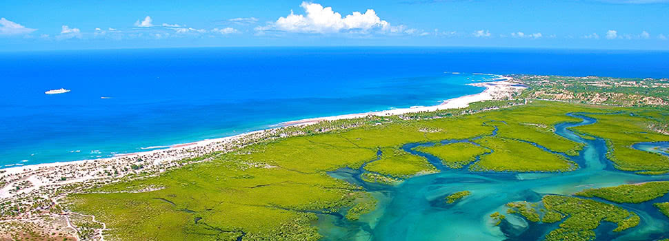
Belize is on the Caribbean coast of northern Central America. It shares a border on the north with the Mexican state of Quintana Roo, on the west with the Guatemalan department of Petén, and on the south with the Guatemalan department of Izabal. To the east in the Caribbean Sea, the second-longest barrier reef in the world flanks much of the 386 kilometres (240 mi) of predominantly marshy coastline. The area of the country totals 22,960 square kilometres (8,865 sq mi), an area slightly larger than El Salvador, Israel, New Jersey, or Wales. The many lagoons along the coasts and in the northern interior reduces the actual land area to 21,400 square kilometres (8,263 sq mi). It is the only Central American country with no Pacific coastline.
Belize is shaped like a rectangle that extends about 280 kilometres (174 mi) north-south and about 100 kilometres (62 mi) east-west, with a total land boundary length of 516 kilometres (321 mi). The undulating courses of two rivers, the Hondo and the Sarstoon River, define much of the course of the country's northern and southern boundaries. The western border follows no natural features and runs north–south through lowland forest and highland plateau.
The north of Belize consists mostly of flat, swampy coastal plains, in places heavily forested. The flora is highly diverse considering the small geographical area. The south contains the low mountain range of the Maya Mountains. The highest point in Belize is Doyle's Delight at 1,124 m (3,688 ft).
Belize's rugged geography has also made the country's coastline and jungle attractive to drug smugglers, who use the country as a gateway into Mexico. In 2011, the United States added Belize to the list of nations considered major drug producers or transit countries for narcotics.
Climate
Belize has a tropical climate with pronounced wet and dry seasons, although there are significant variations in weather patterns by region. Temperatures vary according to elevation, proximity to the coast, and the moderating effects of the northeast trade winds off the Caribbean. Average temperatures in the coastal regions range from 24 °C (75.2 °F) in January to 27 °C (80.6 °F) in July. Temperatures are slightly higher inland, except for the southern highland plateaus, such as the Mountain Pine Ridge, where it is noticeably cooler year round. Overall, the seasons are marked more by differences in humidity and rainfall than in temperature.
Average rainfall varies considerably, from 1,350 millimetres (53 in) in the north and west to over 4,500 millimetres (180 in) in the extreme south. Seasonal differences in rainfall are greatest in the northern and central regions of the country where, between January and April or May, less than 100 millimetres (3.9 in) of rainfall per month. The dry season is shorter in the south, normally only lasting from February to April. A shorter, less rainy period, known locally as the "little dry", usually occurs in late July or August, after the onset of the rainy season.
Hurricanes have played key—and devastating—roles in Belizean history. In 1931, an unnamed hurricane destroyed over two-thirds of the buildings in Belize City and killed more than 1,000 people. In 1955, Hurricane Janet levelled the northern town of Corozal. Only six years later, Hurricane Hattie struck the central coastal area of the country, with winds in excess of 300 km/h (185 mph) and 4 m (13 ft) storm tides. The devastation of Belize City for the second time in thirty years prompted the relocation of the capital some 80 kilometres (50 mi) inland to the planned city of Belmopan.
In 1978, Hurricane Greta caused more than US$25 million in damages along the southern coast. In 2000, Hurricane Keith, the wettest tropical cyclone in the nation's record, stalled, and hit the nation as a Category 4 storm on 1 October, causing 19 deaths and at least $280 million in damage. Soon after, on 9 October 2001, Hurricane Iris made landfall at Monkey River Town as a 235 km/h (145 mph) Category 4 storm. The storm demolished most of the homes in the village, and destroyed the banana crop. In 2007, Hurricane Dean made landfall as a Category 5 storm only 40 km (25 mi) north of the Belize–Mexico border. Dean caused extensive damage in northern Belize.
In 2010, Belize was directly affected by the Category 2 Hurricane Richard, which made landfall approximately 32 kilometres (20 mi) south-southeast of Belize City at around 00:45 UTC on 25 October 2010.[ The storm moved inland towards Belmopan, causing estimated damage of BZ$33.8 million ($17.4 million 2010 USD), primarily from damage to crops and housing.
The most recent hurricane to affect the nation was Hurricane Nana in 2020.
Economy
Belize has a small, mostly private enterprise economy that is based primarily on agriculture, agro-based industry, and merchandising, with tourism and construction recently assuming greater importance. The country is also a producer of industrial minerals, crude oil, and petroleum. As of 2017, oil production was 320 m3/d (2,000 bbl/d). In agriculture, sugar, like in colonial times, remains the chief crop, accounting for nearly half of exports, while the banana industry is the largest employer. In 2007 Belize became the world's third largest exporter of papaya.
The government of Belize faces important challenges to economic stability. Rapid action to improve tax collection has been promised, but a lack of progress in reining in spending could bring the exchange rate under pressure. The tourist and construction sectors strengthened in early 1999, leading to a preliminary estimate of revived growth at four percent. Infrastructure remains a major economic development challenge;[97] Belize has the region's most expensive electricity. Trade is important and the major trading partners are the United States, Mexico, the United Kingdom, the European Union, and CARICOM.
Belize has four commercial bank groups, of which the largest and oldest is Belize Bank. The other three banks are Heritage Bank, Atlantic Bank, and Scotiabank (Belize). A robust complex of credit unions began in the 1940s under the leadership of Marion M. Ganey, S.J.
Cuisine
Belizean cuisine is an amalgamation of all ethnicities in the nation, and their respectively wide variety of foods. It might best be described as both similar to Mexican/Central American cuisine and Jamaican/Anglo-Caribbean cuisine but very different from these areas as well, with Belizean touches and innovation which have been handed down by generations. All immigrant communities add to the diversity of Belizean food, including the Indian and Chinese communities.
The Belizean diet can be both very modern and traditional. There are no rules. Breakfast typically consists of bread, flour tortillas, or fry jacks (deep fried dough pieces) that are often homemade. Fry jacks are eaten with various cheeses, "fry" beans, various forms of eggs or cereal, along with powdered milk, coffee, or tea. Tacos made from corn or flour tortillas and meat pies can also be consumed for a hearty breakfast from a street vendor. Midday meals are the main meals for Belizeans, usually called "dinner". They vary, from foods such as rice and beans with or without coconut milk, tamales, "panades" (fried maize shells with beans or fish), meat pies, escabeche (onion soup), chimole (soup), caldo, stewed chicken, and garnaches (fried tortillas with beans, cheese, and sauce) to various constituted dinners featuring some type of rice and beans, meat and salad, or coleslaw. Fried "fry" chicken is another common course.
In rural areas, meals are typically simpler than in cities. The Maya use maize, beans, or squash for most meals, and the Garifuna are fond of seafood, cassava (particularly made into cassava bread or ereba), and vegetables. The nation abounds with restaurants and fast food establishments that are fairly affordable. Local fruits are quite common, but raw vegetables from the markets less so. Mealtime is a communion for families and schools and some businesses close at midday for lunch, reopening later in the afternoon.
Religion
According to the 2010 census, 40.1% of Belizeans are Roman Catholics, 31.8% are Protestants (8.4% Pentecostal; 5.4% Adventist; 4.7% Anglican; 3.7% Mennonite; 3.6% Baptist; 2.9% Methodist; 2.8% Nazarene), 1.7% are Jehovah's Witnesses, 10.3% adhere to other religions (Maya religion, Garifuna religion, Obeah and Myalism, and minorities of The Church of Jesus Christ of Latter-day Saints, Hindus, Buddhists, Muslims, Baháʼís, Rastafarians and other) and 15.5% profess to be irreligious.
According to PROLADES, Belize was 64.6% Roman Catholic, 27.8% Protestant, 7.6% Other in 1971.[125] Until the late 1990s, Belize was a Roman Catholic majority country. Catholics formed 57% of the population in 1991, and dropped to 49% in 2000. The percentage of Roman Catholics in the population has been decreasing in the past few decades due to the growth of Protestant churches, other religions and non-religious people.[126]
In addition to Catholics, there has always been a large accompanying Protestant minority. It was brought by British, German, and other settlers to the British colony of British Honduras. From the beginning, it was largely Anglican and Mennonite in nature. The Protestant community in Belize experienced a large Pentecostal and Seventh-Day Adventist influx tied to the recent spread of various Evangelical Protestant denominations throughout Latin America. Geographically speaking, German Mennonites live mostly in the rural districts of Cayo and Orange Walk.
The Greek Orthodox Church has a presence in Santa Elena.
The Association of Religion Data Archives estimates there were 7,776 Baháʼís in Belize in 2005, or 2.5% of the national population. Their estimates suggest this is the highest proportion of Baháʼís in any country. Their data also states that the Baháʼí Faith is the second most common non-Christian religion in Belize, followed by Judaism. Hinduism is followed by most Indian immigrants, however, Sikhs were the first Indian immigrants to Belize (not counting indentured workers), and the former Chief Justice of Belize George Singh was the son of a Sikh immigrant, there was also a Sikh cabinet minister. Muslims claim that there have been Muslims in Belize since the 16th century having been brought over from Africa as slaves, but there are no sources for that claim. The Muslim population of today started in the 1980s. Muslims numbered 243 in 2000 and 577 in 2010 according to the official statistics. and comprise 0.16 percent of the population. A mosque is at the Islamic Mission of Belize (IMB), also known as the Muslim Community of Belize. Another mosque, Masjid Al-Falah, officially opened in 2008 in Belize City.
Explore the beauty and culture of Western Belize and all it has to offer on your own time-frame and at your own pace.













 Name: BondExcel
  Name: Businessentials For Hospitality
  Name: Capital Efficiency Group
  Name: D E I R D R E R E N N I E R S Interior Design
  Name: De Leeuw Valuers Cape Town
  Name: E C Mobility
  Name: Edward Tokolo Kasete
  Name: Electrolux Professional
  Name: Exquisite Hotel Consultants' Hospitality Training Department
  Name: FVE Interiors
  Name: Healing Earth
  Name: Hospro
  Name: Hotel Revenue Management
  Name: Indigo Real Estate Agency
  Name: Lisa Dunn - Tourism Grading Assessor
  Name: Ooba (Pty) Ltd
  Name: SK Sambu Tours & Transfers
  Name: Soul Private Collection
  Name: The Dumb Butler Hospitality Suppliers
  Name: The High Street Auction Company
  Name: Touch Point Retail
2025-10-16 06:10
Лучший досуг для мужиков только тут - [url=https://prostitutki-klin-sexplanet.com]https://prostitutki-klin-sexplanet.com[/url]